
Our TRRA Planning Sub Committee monitors all D.A.’s of interest submitted to Council and the Department of Planning and regularly updates Committee Members on current submissions etc. We thought that this information should be shared with our membership so check on this post regularly to keep up to date on what is going on in your area.
TRRA DA Watch September 2015
Updates include: Soldiers Point Marina, Anna Bay Resort, Seniors living at Diggers, more ‘caravan park’ housing, Rural residential Strategy, Floodplain Management, Corlette Point Foreshore
Lots happening in the last few months.
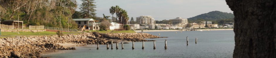
The controversial Soldiers Point Marina expansion is back. Following rejection of the previous plan by the Joint Regional Planning Panel (JRPP) in June 2014: HERE, the applicant has now submitted a substantially similar application, but with a slightly revised layout and parking arrangements. Two large volumes – an Environmental Impact Study (EIS) and Species Impact Study (SIS) – are on exhibition at the Tomaree Library until 24 October 2015. Now that the new DA Tracker system is operating these documents are also available online for viewing or download (DA No 2015/586). TRRA will be making an assessment and probably a submission.
The huge The Bay Resort ‘International Eco-experience’ development proposed for a site just north of Nelson Bay Rd at Anna Bay (behind the old wooden church) has been reported on previously: HERE, and TRRA made a submission. We have subsequently met with a consultant to the developer who explained how they aim to make the development both commercially viable and environmentally sensitive. The matter is now in the hands of the Department of Planning, which rejected (on multiple grounds) a previous version of the proposal (but on much bigger footprint) back in 2005-06.
We have become aware of a proposed development by Wests Leagues Club on the site of the western car park at the Nelson Bay Diggers Club on Shoal Bay Road. It is for 111 ‘Seniors living’ units in two apartment blocks of 8 and 10 storeys. They have not yet lodged a development application (DA) but are first seeking a ‘Certificate of compatibility’ to overcome current zoning restrictions. It is not clear how they propose to overcome the other control in the Local Environment Plan (LEP) which limits building heights on the various parts of site to 4 and 5 storeys. Long-time residents will recall major opposition to high buildings on the then RSL land when a major redevelopment of the Club was proposed back in 2008 (Wests settled for a more modest renovation when they took over). The 7 storeys proposed back in 2008 were considered unacceptable by many in the community – not least because they would be visible from the Bay, breaking above the natural treeline. The Marina Resort: HERE, has of course now been approved contrary to the height limits, already breaching the preferred defence of the natural landscape east of the town centre. We will be following this proposal closely and preparing to fight it if necessary.
A modification is proposed (DA 2007-15-2) to the already approved ‘caravan park’ at 16 Trotters Road, Anna Bay (between Nelson Bay Road and Fenningham’s Island). Like the other park approved in 2013 on the former Divers Luck winery site immediately to the south (DA, this one has a large component of manufactured homes for permanent occupation. TRRA has consistently opposed approval of these types of development on rural land away from urban services and amenities, not least because they clearly breach the intention of the zoning controls. They have been approved under a provision that allows ‘tourism developments’ on rural land, which we think is designed for low density visitor accommodation – not for high density residential development. The current application states that it is only for a net extra 13 sites, but it would also change the balance – the proportion of sites available for permanent residences would increase from 47% to 59%. The two adjacent approved parks would have a combined total of around 300 2 or 3 bedroomed units for permanent occupation. If this scale of residential development was proposed under a normal subdivision, it would be given much closer scrutiny and required to meet much higher planning and development control standards.
TRRA acknowledges that the many residential home parks in Port Stephens meet an important need, and that demand for low cost accommodation is strong. But there is a right and a wrong way to meet this demand, and our contention is that use of a ‘tourism’ loophole on rural land not adequately supported by urban services is the wrong way. We have made a submission opposing this modification which compounds the original mistake.
Council has put on exhibition a draft Rural Residential Strategy, which provides a framework for subsequent applications to rezone and subdivide rural land for residential developments of more than 10 lots. It seems to have limited application to the Tomaree peninsula, where various environmental and planning controls severely limit the area of land to which the new Strategy would apply. We continue to assess the proposal with a view to making a submission before the deadline of 8 October.
Council also has had two draft Flood Plain Management Plans on exhibition – for Medowie and for Williamtown/Salt Ash. While these are outside our area, they have significant implications for Council planning policy and for the visual future of the approaches to the Tomaree peninsula.
The Williamtown/Salt Ash study has highlighted the low-lying coastal areas, such as those surrounding Fullerton Cove and Tilligerry Creek are at particularly high risk to climate change. “The issue of future sea level rise presents particular challenges to future development, as the risks associated with flooding will progressively increase during the lifetime of the development.”
Currently under existing conditions the report has found 14 residential homes, 4 commercial buildings and 1 community building have floor levels below the existing 1% AEP flood level, however using current Council policy on sea level rises, future 1% AEP flood level (incorporating 0.4m sea level rise allowance and 20% increase in flow) it is expected that this will increase to a staggering – 192 residential homes, 25 commercial buildings and 4 community building /public infrastructure will be affected. This has major implications particularly to the existing and planned “tourist” developments of fast food outlets near the corner of Nelson Bay Road and Cabbage Tree Road/Lavis Lane which TRRA has raised in past submissions.
The report calls for “Land use planning and development controls are key mechanisms by which Council can manage flood-affected areas within Williamtown-Salt Ash.”
It goes on to state “Investigated in isolation, a number of these areas show potential for future redevelopment (including large scale filling/earthworks) with limited impact on existing flood conditions. However, a more coordinated flood impact assessment is recommended comprising a full cumulative development assessment with consideration of regional development opportunities across the Lower Hunter River floodplain incorporating the Port Stephens and Newcastle LGAs”. TRRA welcomes this call for a more coordinated look at the impact of developments rather than individual DA’s being considered in isolation.


Another consultation is on a report and options for management of foreshore erosion at Corlette between the Anchorage marina and western end of Bagnall’s Beach, including Conroy Park and Corlette Point. The REPORT aims to balance various objectives including public access, protection of private properties and prevention of further loss of public land. The options are costed at between $4.2 million and $7.6 million, although it is expected that a final approach may be a hybrid with elements from each option. It is not clear if ongoing maintenance costs have been estimated, and in any case there is currently no funding set aside. A public meeting on 23 September made clear that there are strong competing views. Submissions should be made by 16 October.
Nigel, Geoff & John – Planning Sub Committee
